Weather Operations in Jordan: Examples

Case Study: Jordan, Dec. 1st, 2016
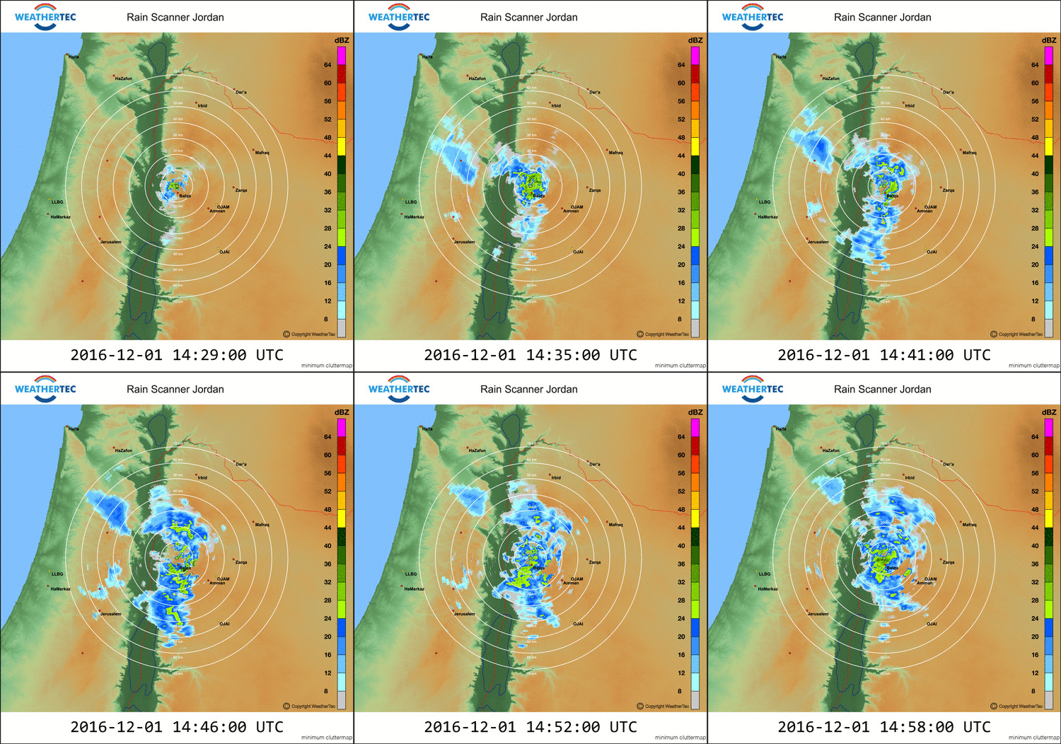
Rapid evolvement and growth of beginning small cells led to extensive precipitationAn instable air mass was advecting clouds to Jordan. The prevailing southwesterly winds led this very humid air to the WeatherTec influence areas. An evolvement of precipitation cells was initiated.
While passing the three southerly WeatherTec ionization influence areas Kufranjeh to Madaba a rapid growth and increase in intensity easterly of the ionization sites were clearly visible.
The initiated rain cells were growing more and more within the influence areas and became considerable intensities and dimensions. As a result, the enhanced amount of rain could be brought further into the country.

Case Study: Jordan, Dec. 13th, 2016
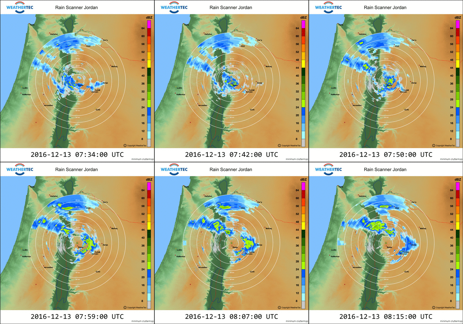
Enhancement between WeatherTec stations Salt and Deir Abu SaidA low-pressure system with its accompanying front was passing from West. Precipitation cells could pass the Jordan Valley and reached the sites Salt and Deir Abu Said.
With entering of these cells into the ionization influence areas the dimensions and intensities were growing and led to an increase of the precipitation amount for Jordan. This enabled a further inland passing.

Case Study: Jordan, Dec. 14th, 2016
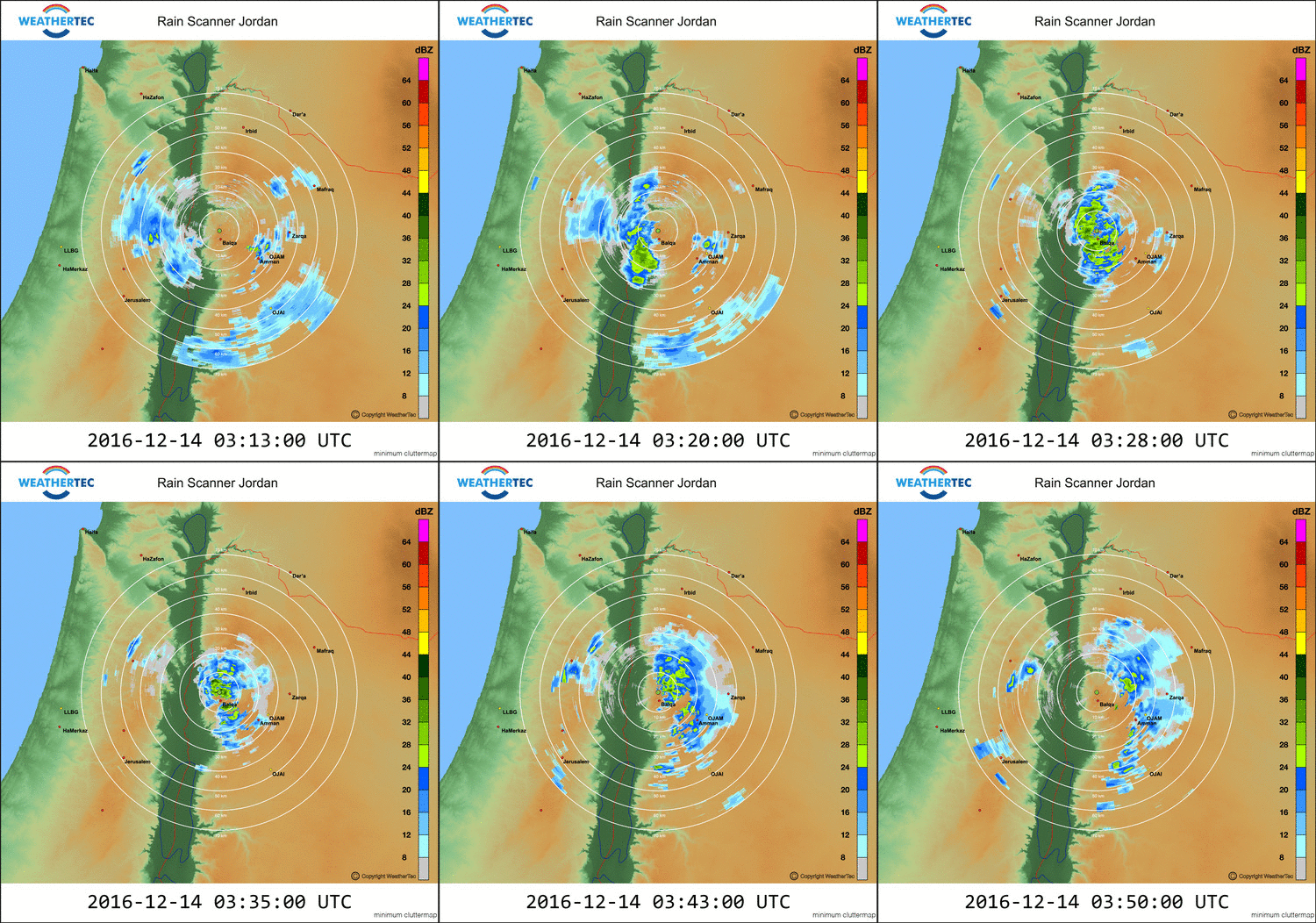
A beginning weak precipitation cell were initiated to rain out many times greaterAfter passing of a cold front high instability was following and brought convective rain cells to North Jordan. A precipitation cell appeared westerly of the Jordan Valley coming from Southwest.
With passing the WeatherTec ionization area Salt a rapid growing in intensity were detected on the rain radar.
Also, a growing in dimension was visible and led to a higher amount of freshwater in form of precipitation also further into the country.


